|
Linguistic/cultural
units in part of Arnhem Land
Arnhem Land is
some 150 0002 km of the Top End of the Northern
Territory. The Yolngu cultural bloc of central and eastern
Arnhem Land is delineated by the area coloured yellow.
The Blyth River approximates the western boundary with central
Arnhem Land (the Glyde River, which the Goyder runs into,
is closer to the actual boundary), the headwaters of the Goyder
River the southwestern boundary, and the Walker River the
southern boundary. An area roughly 250 X 150 kilometres (37,500km2).
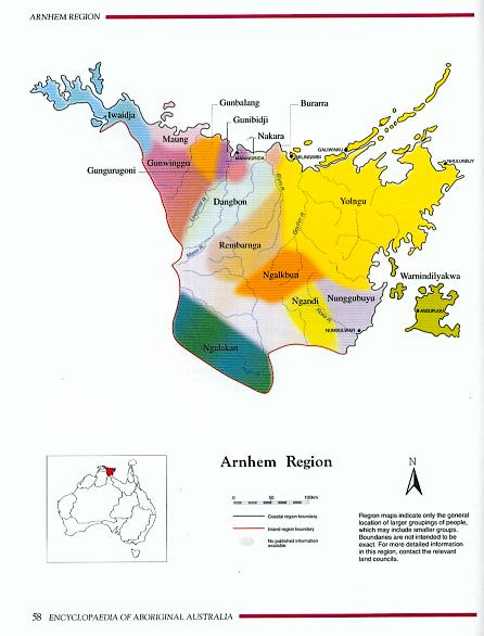
Only
some of the eastern portion of western Arnhem Land (that
area west of the Liverpool River) is shown on this map.
|
Taken
from The Encyclopaedia of Aboriginal Australia, David Horton
(general Editor), 1994, Volume 1, Aboriginal Studies Press
for AIATSIS, Canberra.
|